


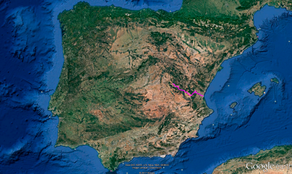
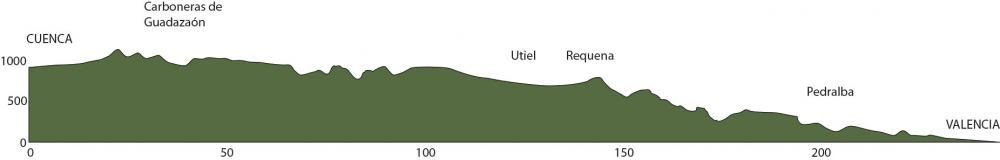
Distance 253 Km. distributed across roads of the following types:
Carreteras Nacionales: 35 km. Autonómicas de 2º nivel: 59 km. Autonómicas de 3º nivel:138.1 km. Asfalto o cemento sin nombre: 20.9 km.
Sections: 12
Autor: Gérard
Descripción:
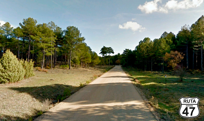
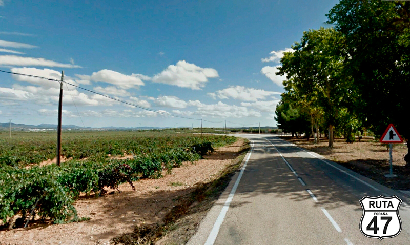
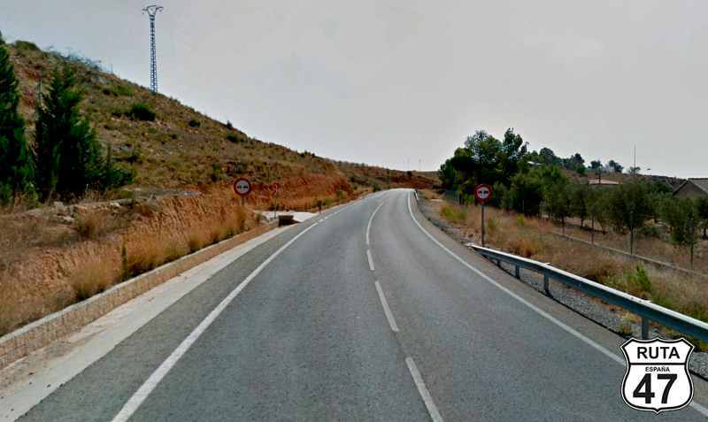
Tramo 1: CUENCA - N-420 (4.5 Km)
After an interesting sightseeing tour, we leave the city of the hanging houses to meet the Mediterranean for the third and final time, hand in hand with Valencia, and take the opportunity to savor one of its famous Paellas.
So, we leave Cuenca heading south, and after 4 km, we leave the N-320 towards Madrid, Guadalajara, and Teruel. CAUTION, above this informative sign, another sign indicates the direction to Valencia, but we will take a little detour. We're on a motorcycle, and the charm is in the journey more than in the destination.
Once we take the exit, we make a large curve to join the N-420 towards Teruel.
Final del tramo

Tramo 2: N-420 - Vecinal (6.7 Km)
In search of secondary roads, we now ride on the N-420, which we will leave after traveling on it for almost 7 km to take a detour on roads of greater interest for motorcyclists and return within a couple of sections.
Riding on this road, which lacks curves in this stretch, and after passing PK 441, we turn left towards Las Torcas.
Final del tramo

441
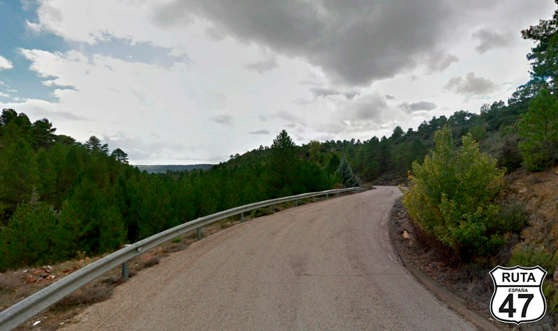
Tramo 3: Vecinal - CU-V-9142 (20.9 Km)
A sign with the silhouettes of Don Quixote and Sancho Panza indicates that through this local road, we are traveling on the Route of the Southern Serranía de Cuenca. The landscape of cultivated fields changes as soon as we cross the railroad track via an overpass, becoming a bit more mountainous, and consequently, some curves begin to appear.
We are in the Torcas de Palancares, one of the most impressive landscapes in the province of Cuenca. In it, there are enormous depressions ranging from thirty to five hundred meters in diameter, 80 million years old. Since this stage is not too long, we have enough time, and one of these Torcas is next to the road. We couldn't resist the temptation to visit it, deviating a bit from the route.
So at the end of the stretch, instead of turning right, we turn left, continuing for another kilometer to admire this beauty called La Torca de la Gitana.
We go back to the intersection we just passed and head towards Cañada del Hoyo.
Final del tramo

Tramo 4: CU-V-9142 - N-420 (7.1 Km)
Leaving behind the impressive and ancient Torcas de Palancares, we now travel on the CU-V-9142, at the same time leaving behind the wooded landscape of the previous stretch.
Halfway before reaching the N-420 again, we pass through the town of Cañada del Hoyo, and after a few minutes, we reach a T-shaped intersection where we will turn left to reunite with the National road we have traveled before.
Final del tramo

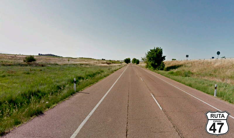
Tramo 5: N-420 - CM-2109 (10.8 Km)
Two long straight stretches preceded by a short section of open curves take us through this National road until a turnoff towards Cardenete and Utiel.
Final del tramo

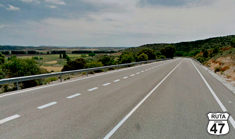
Tramo 6: CM-2109 - CV-470 (59 Km)
We can relax for about 40 minutes until the next intersection, as this is a long stretch. A whopping 59 km will take us on this second-level regional road, which, due to its width and well-maintained asphalt, could very well be a National road.
Initially, this road is quite fast, traveling through a route dominated by straight stretches as we pass very close to the towns of Carboneras de Guadazaón, Arguisuelas, and Cardenete. From here, the landscape begins to change, and the presence of trees becomes more and more prominent, along with curves that reach their maximum splendor in two short ascents and a descent that will take us to the town of Mira.
Shortly after, we reach kilometer 109 of the route, entering the province of Valencia and leaving behind the province of Cuenca.
Final del tramo

Tramo 7: CV-470 - Utiel (25 Km)
Shortly after starting this stretch, we reach Camporrobles on a straight road that we began in the previous province.
Subsequently, during the 25 km of this wide, yellow road with few curves, we reach Utiel, leaving behind the towns of Camporrobles and Las Cuevas.
After entering Utiel, a fairly populous town, we leave it behind seeking the N-III road towards Teruel.
Final del tramo

Tramo 8: Utiel - Requena (13 Km)
Avoiding highways and expressways like the plague, we now travel on the N-III, the bulk of its traffic being supported by the A-3, also known as the Mediterranean Expressway, which ends in Valencia and will accompany us a few meters to the right until we reach Requena, where we will continue on secondary roads.
During this journey, a couple of roundabouts give us the opportunity to join the A-3, but we will continue on the lonely N-III for today. After entering Requena, we turn northeast, joining the CV-395.
Final del tramo
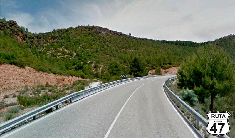
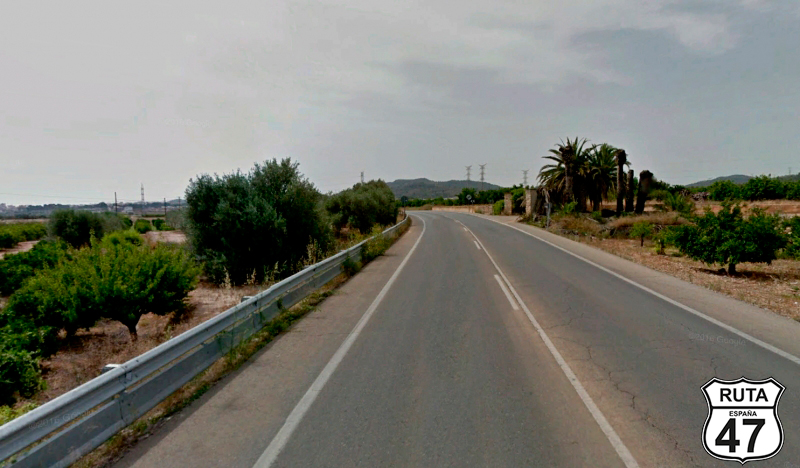
Tramo 9: Requena - CV-396 (47 Km)
We leave Requena passing through two roundabouts, one located before and another after passing under the A-3, heading towards Chera and Villar del Arzobispo, taking the first exit at this last roundabout.
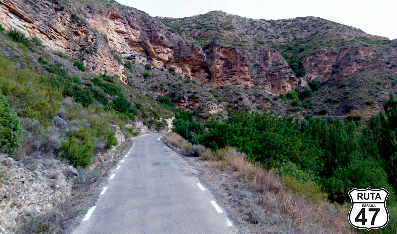
We now begin the most enjoyable stretch of this route, where curves of all kinds make their presence felt as we cross the Chera Sot de Chera Natural Park, an emblematic natural space for the Valencian Community.
The winding layout of these 47 km of narrow road, with beautiful views of the Buseo Reservoir, which can be seen for a while, adds the finishing touch to this stage from Cuenca to Valencia. The section 9, through which we are now traveling, has its endpoint at a roundabout where we will take the first exit towards Bugarra and Gestalgar.
Final del tramo

47
Tramo 10: CV-396 - CV-377 (12 Km)
Without joining the CV-35, which would take us directly to Valencia, we choose the CV-396, a more secondary, solitary, and winding road, for which we will take a little detour.
The first part of the stretch is quite straight, with a very open landscape, and as we approach its end, the asphalt narrows, becoming typical of these third-level regional roads, while we begin to ride among orange groves, a typical landscape of this Valencian province.
At kilometer 206 of the route, we come to a stop sign where we will turn left towards Bugarra.
Final del tramo
0
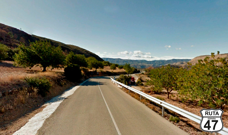
Tramo 11: CV-377 - Pedralba (7 Km)
Shortly after starting this short stretch of 7 km, we reach Bugarra, where we encounter the Turia River, which flows into the Valencian capital and will accompany us at a certain distance throughout the stretch, which ends in the next town: Pedralba.
Final del tramo
Tramo 12: Pedralba - VALENCIA (40 Km)
We approach the last stretch of this route by entering a roundabout where we will take the first exit towards Vilamarxant and Cheste, famous among other things for hosting its speed circuit, eligible for the Motorcycle Grand Prix. At this precise moment, we will cross the Turia River, which we will lose sight of for a while, only to reunite with it in the town of Vilamarxant. From this moment on, we won't travel 100 meters without seeing some buildings until our final destination: Valencia.
We can still do some sightseeing in the city and even take a swim at Malvarosa Beach before having a paella for dinner.
Final del tramo