


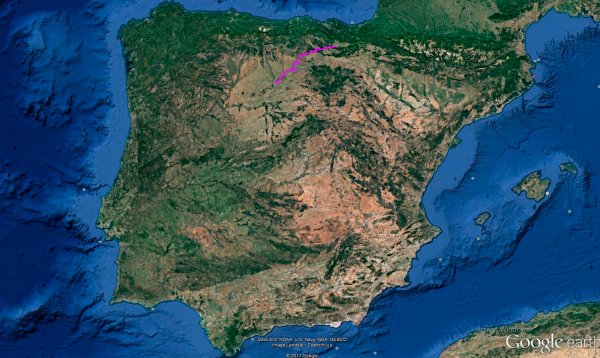
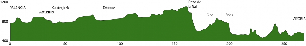
Distance 268 Km. distributed across roads of the following types:
Autopistas y autovías: 2 km. Carreteras Nacionales: 16 km. Autonómicas de 2º nivel: 165.9 km. Autonómicas de 3º nivel:84.1 km.
Sections: 30
Autor: Gérard
Descripción:
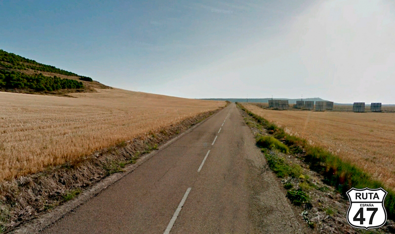
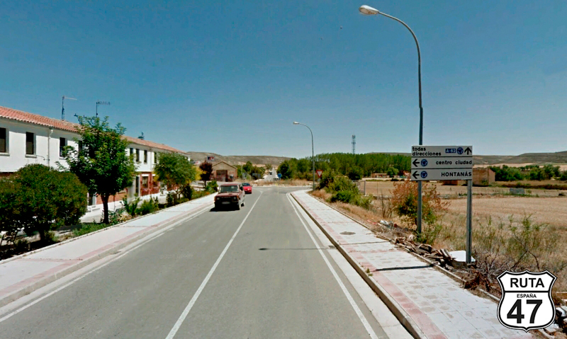
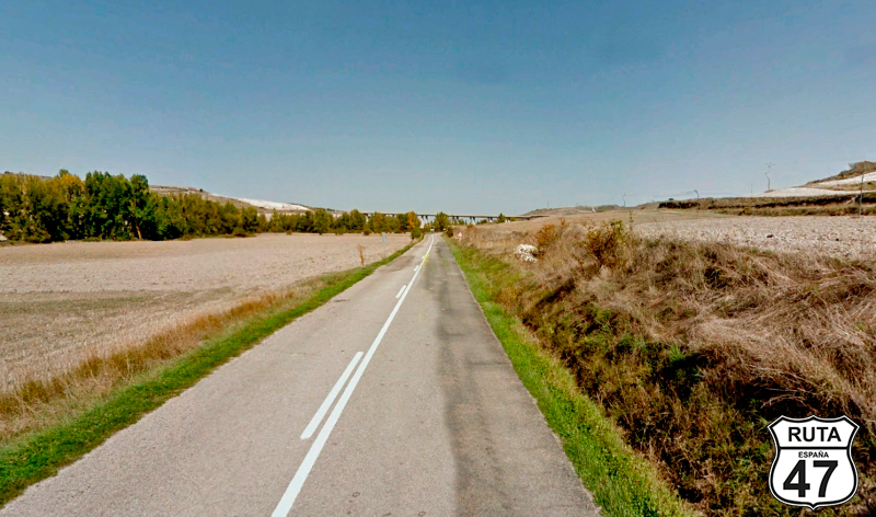
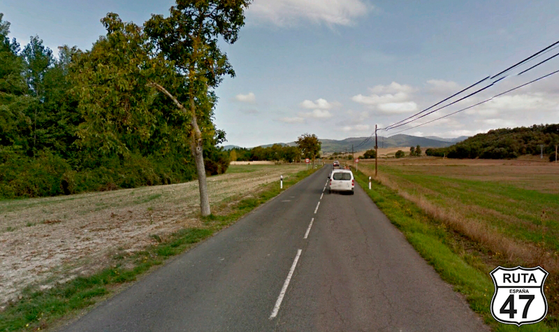
Tramo 1: PALENCIA - Villalobón (2.8 Km)
After strolling through the beautiful main street and visiting the Cathedral of San Antolín, nicknamed The Beautiful Unknown, we left this small city in Castilla y León via P-405.
Of the almost 40 km that this road spans, we will only cover three for now: the ones leading us to Villalobón, where we will turn right at a small roundabout, taking the first exit.
Final del tramo

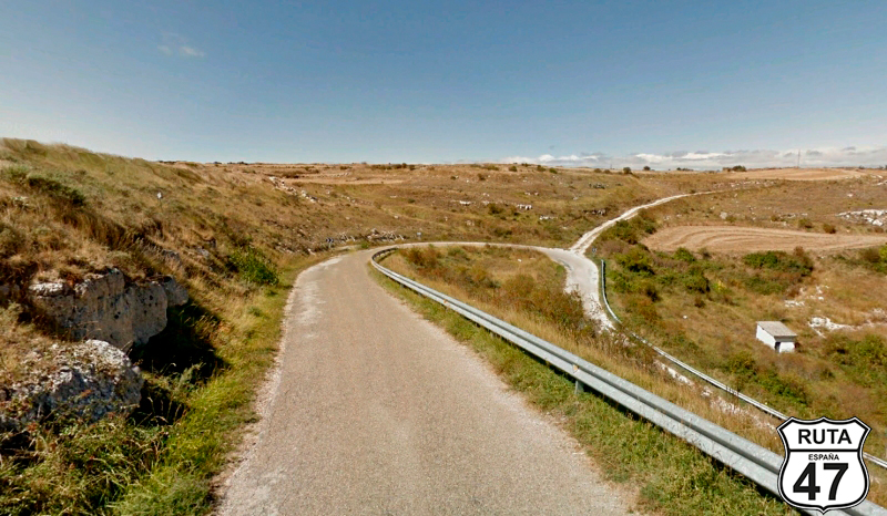
Tramo 2: Villalobón - P-411 (9.7 Km)
We find ourselves in Cerrato Palentino, a unique landscape characterized by several very old mountains of which only the base remains. These mountains are called "páramos," and their layout is uniquely marked by a curved ascent, followed by one or more long straights, and finally another curved descent, where the mountain ends.
Along this route, we will pass through several páramos, and in this section, we encounter the first one.
So, we begin this nearly 10 km stretch with a straight road that crosses the A-67 via an elevated bridge to ascend the páramo through a short curved section. Once at the top, we travel 6 km of straight road adorned on both sides with fields alternating between wheat, barley, and sunflowers. Dozens of fruit trees arranged haphazardly as far as the eye can see break the monotony of this very flat landscape.
After the slight descent from this first páramo, we pass by the side of Valdeolmillos, and a few meters later, we turn right towards Villamediana and Torquemada.
Final del tramo

Tramo 3: P-411 - Villamediana (4.5 Km)
The story repeats in this stretch: first a gentle ascent, a couple of long straights, and a descent that this time leads us to Villamediana.
Villamediana is an ordinary village in Cerrato Palentino, but among other things, it holds the peculiarity that part of a masterpiece of Basque literature was written there. We are talking about "Obabakoak," a book written in Basque, adorned with several awards, and translated into more than 20 languages. Its author, Bernardo Atxaga, lived in this town for 8 months while writing part of his book.
Final del tramo

Tramo 4: Villamediana - P-405 (16.6 Km)
We leave the green roads for a moment and exit Villamediana via PV-4112, which being yellow, logically, is narrower than the aforementioned green ones. This one is no exception. In addition, the asphalt is a bit worn, and there are a few potholes, but if you take it easy, it goes very well.
This páramo, unlike the previous ones, is not cultivated and is densely populated with trees, making the landscape not as open as what we are seeing in this area of Cerrato.
Under the descent of this tree-covered páramo, you'll find the intersection marking the end of this stretch. As a curiosity, a few meters from this intersection, a Roman Villa is buried, discovered in the 80s of the last century. Once the significant findings were extracted, it was reburied due to budget constraints.
Final del tramo
Tramo 5: P-405 - BU-405 (9.8 Km)
After turning right at the previous intersection, we advance about 4 kilometers and reach Astudillo, a beautiful medieval village where Pedro I, the Cruel, or Pedro I, the Just, depending on who you ask, had his lover María de Padilla.
Historical curiosities aside, it's worth riding the motorcycle up to its ruined castle to view the beauty of this characteristic village and admire the boundaries of Tierra de Campos and Cerrato. Astudillo is the boundary of these two well-differentiated landscapes. On one side, you see the vastness of Tierra de Campos, and on the other, those small mounds populated with small trees, like páramos. In this area, they are populated with wind farms.
Continuing on P-405 and without leaving the town, we will reach a gas station next to a roundabout. There, we take the first exit and continue on this road for another 7 kilometers until, without entering any intersections, we enter the province of Burgos.
A little before changing provinces, we have encountered the Pisuerga River, which will accompany us for a while during the next stretch.
Final del tramo

35
Tramo 6: BU-405 - Castrojeriz (11.4 Km)
A row of lush poplars on the left betrays the proximity of the Pisuerga River, which we will lose sight of in a few kilometers as we approach Pedrosa del Príncipe. We will traverse it at a very slow pace.
Between cultivated fields crossed by the long straight road we are traveling on, we pass another small urban nucleus called Hinestrosa, and shortly after, we reach a roundabout with Castrojeriz ahead. At this roundabout, we will turn right, heading towards Castrojeriz.
Final del tramo
Tramo 7: Castrojeriz - BU-P-4013 (0.5 Km)
Castrojeriz is another one of those towns worth visiting, if only to stroll through its medieval streets. Moreover, we would recommend going up to its castle, which is located on a hill and can be reached by motorcycle, though it must be noted that not every motorcycle is suitable. From this point, there are breathtaking views of the area in general and of the town in particular, where you can admire the graceful Collegiate Church of Our Lady of the Apple Tree.
Just 500 meters from the roundabout where we entered Castrojeriz, we conclude this stretch at another roundabout where we will take the second exit, delving even further into Castrojeriz.
Final del tramo

16
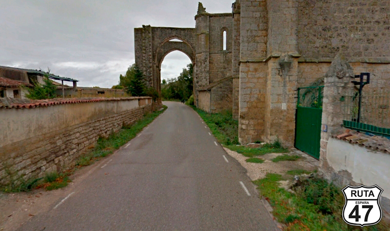
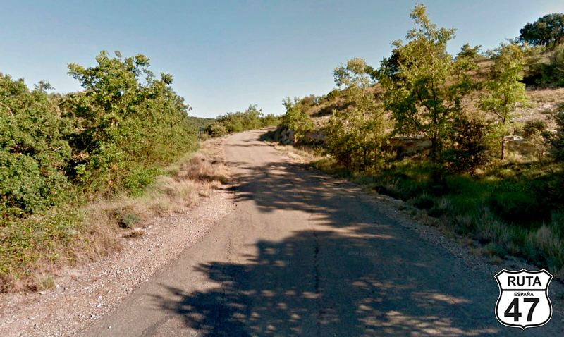
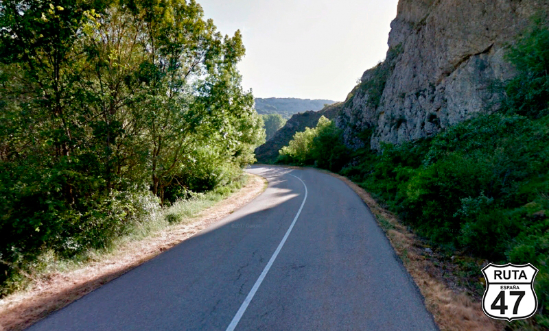
Tramo 8: BU-P-4013 - BU-P-4041 (13 Km)
The 13 kilometers of this stretch, which we will ride on a narrow road, sometimes with trees on both sides providing shade on the way, coincide with the Camino de Santiago. Therefore, we will likely encounter some pilgrims walking in the opposite direction.
A few kilometers from Castrojeriz, we pass under the ruins of the Monastery of San Antón, an ancient pilgrims' hospital. Legend has it that the amputated limbs of pilgrims hung from its walls to announce that this building was a hospital.
Following the route of the Camino de Santiago, we advance 6 kilometers through a curved ascent and reach a T-shaped intersection where we will turn right after the corresponding stop sign, heading towards Iglesias.
Final del tramo
Tramo 9: BU-P-4041 - Iglesias (4.6 Km)
After a straight stretch of 2 kilometers on this well-paved narrow third-order regional road, we begin the descent from the páramo we ascended after passing Castrojeriz until we reach Iglesias, located at the lowest part.
On the outskirts of Iglesias and after passing through it, we turn left towards Estepar.
Final del tramo

Tramo 10: Iglesias - Estépar (9.1 Km)
We proceed towards Estepar on this narrow and solitary road with old-school asphalt, surrounded by cultivated fields.
We leave the town of Vilviestre de Muñó behind as we enter Estepar, marking the change of stretch.
Final del tramo

Tramo 11: Estépar - BU-627 (12.1 Km)
In a left turn, we start this stretch rolling along the BU-406 in the company of the Hormazuela River along a straight road. At the end of this straight, we pass under the A-231, a highway that goes from Burgos to León, built to alleviate traffic on the N-120.
A few meters later, we reach a roundabout where we will continue straight, taking the second exit.
Final del tramo

Tramo 12: BU-627 - BU-V-6018 (3.1 Km)
The páramos become more numerous as we advance along this straight and well-paved C-627, where the presence of cultivated fields remains the predominant landscape. The red poppies paint the edges of this agricultural area with color.
Having covered almost 100 kilometers of the route, we conclude this stretch by making a 90º turn towards Villorejo, Tobar, and Las Hormazas.
Final del tramo

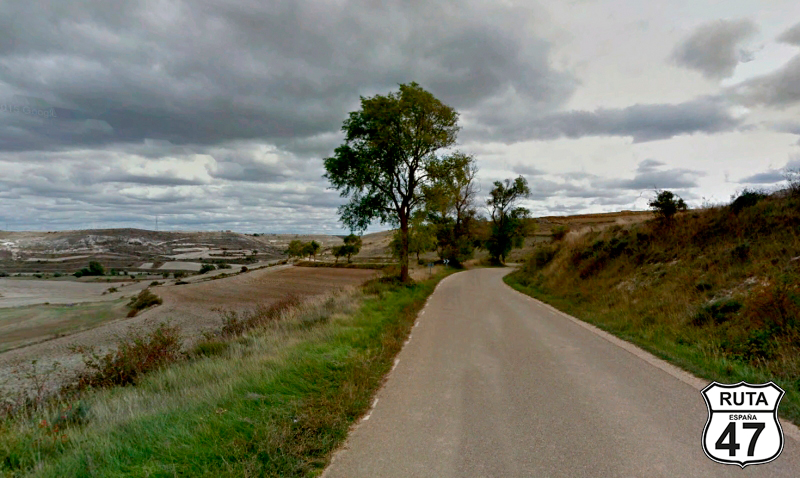
Tramo 13: BU-V-6018 - BU-V-6063 (7.8 Km)
Now, we are heading north on this narrow third-level regional road between Castilian fields, following the silhouette of the páramos' base for 8 kilometers. When we reach a junction, we will turn right towards Susinos and Avellanosa.
Final del tramo
Tramo 14: BU-V-6063 - Avellanosa del Páramo (6 Km)
We begin this stretch by entering Susinos del Páramo.
We have changed roads, but the landscape and asphalt are very similar to the previous one. After 6 kilometers of straight and solitary asphalt, we descend to the town of Avellanosa del Páramo. After passing through this town, we conclude this stretch by turning left towards La Nuez de Abajo and Mansilla de Burgos.
Final del tramo

Tramo 15: Avellanosa del Páramo - BU-622 (7 Km)
We continue to ascend gently through the páramos on the narrow and worn asphalt of BU-V-6066. Once at the top, we ride along a 3 km straight, at the end of which we start a curved descent with a wide curve that will bring us to La Nuez de Abajo.
Almost 1 km later, and after a stop, we turn left towards Aguilar de Campoo and Santibañez de Zarzaguda.
Final del tramo

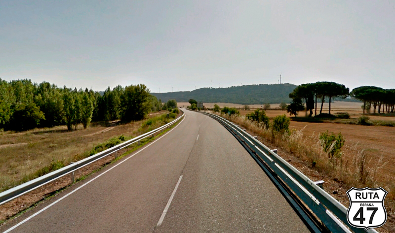
Tramo 16: BU-622 - N-627 (15 Km)
The stretch we are currently riding on has two distinct parts. Firstly, as before, the route consists of long straights connected by a gentle curve as we leave behind the towns of Miñón, Santibañez Zarzaguda, and Huérmeces. After this last town, we leave the Campos de Castilla to ride on a winding path, at the end of which we will join the N-627 towards Aguilar de Campoo, a town we will not pass through.
Final del tramo
Tramo 17: N-627 - BU-601 (5 Km)
The three short minutes we ride on this National road lead us to a right turn after the kilometer point 32, where we will turn right towards Poza de la Sal and Masa.
Final del tramo

32
Tramo 18: BU-601 - BU-503 (6 Km)
Having turned east at the last intersection, we now proceed on this freshly paved road, wider than usual on greenways like this, where the natural landscape is disrupted by a wind farm.
We continue to ascend gently until, after 6 km, we reach a cross-shaped junction that crosses the N-623. We will continue straight.
Final del tramo

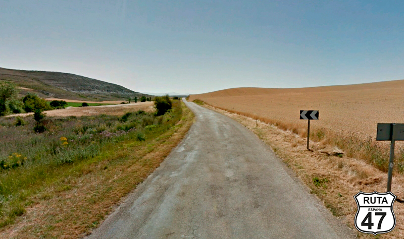
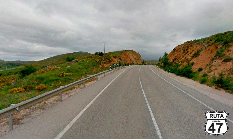
Tramo 19: BU-503 - BU-P-5028 (26 Km)
We are now in the Páramo de Masa, named after the town we will pass through shortly after starting this stretch.
Its 26 km are a joy. The first 17 kilometers have medium-sized straights, but there are also curves, and the narrow asphalt allows us to enjoy the sensation of riding alone on the road. This is a very solitary route.
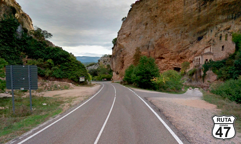
At the end of those 17 km, we come across a monument to Felix Rodriguez de la Fuente, a famous naturalist who, among other feats, increased airport security by using falcons to scare away other birds. His birthplace is in Poza de la Sal, the next town we will pass through.
A few meters after the monument, and after passing through a kind of corridor, the landscape opens up incredibly, revealing a vast expanse of mountains of all kinds adorned with the winding road we will soon be traveling.
During the descent, we pass by the Castle of Los Rojas, built on a large rock, with incredible views. It's well worth taking a break to climb to the castle and admire the landscape.
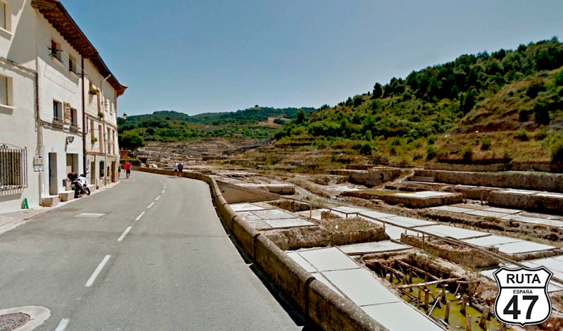
We descend even further along a winding road until we reach Poza de la Sal, a charming medieval village with narrow streets that owes its name to its old salt flats.
We have now covered more than half of the route. This is a good time for lunch, and you can do so at Rte. Casa Martín, located on the outskirts of the village. The building may not be as charming as those in the historic part, but the food is good, and the prices are reasonable.
After the lunch break, we travel another 2 km on the BU-502 and change to the next stretch but continue straight towards Salas de Bureba.
Final del tramo

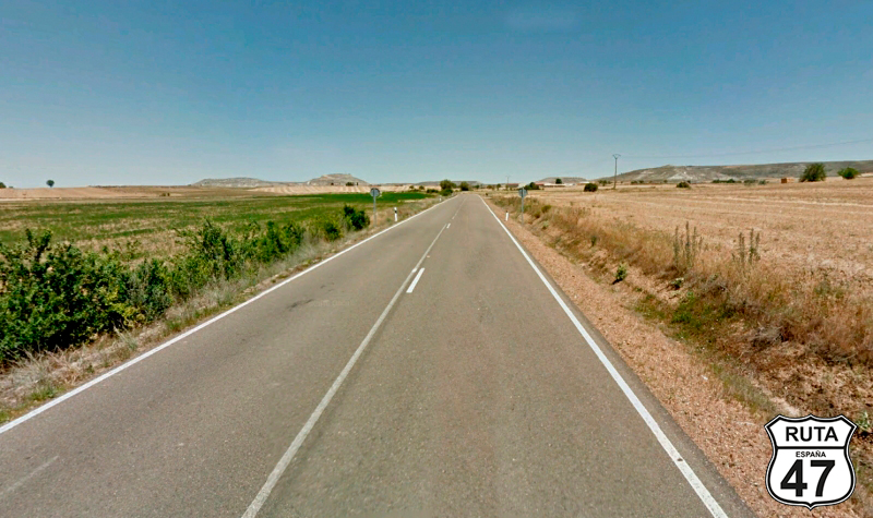
Tramo 20: BU-P-5028 - N-232 (8 Km)
We are now in the region of La Bureba.
After a straight of 3 km, we arrive at Salas de Bureba to continue on a route with not too many curves, leading us to the end of the stretch at a junction where we will join the N-232 towards Oña and Santander.
Final del tramo
Tramo 21: N-232 - Oña (3 Km)
3 km of wide and fast asphalt separate the junction we just left from Oña, our next medieval destination that we will reach by skirting the Natural Space of the Montes Obarenes.
Be very careful because 350 meters after the Oña gas station, there is a little hidden junction where we must turn right towards Barcina de los Montes.
Final del tramo
Tramo 22: Oña - BU-504 (12 Km)
Now we begin a stretch in the first half of which we will encounter a large number of ascending curves, although the asphalt is a bit damaged.
Between each curve, we leave behind the small hamlet of Penches, and as the landscape opens up, we reach Barcinas de los Montes.
4 km later, a crossroads located in La Aldea, where we will turn left towards Cubilla, marks the end of this stretch.
Final del tramo

Tramo 23: BU-504 - Frías (9 Km)
After having arrived here very slowly from Oña, we can make up for it a bit by stepping on the accelerator during these 9 km of good and wide asphalt with open curves until we reach Frías, the smallest medieval town in Spain, crowned by the Castle of Los Velasco, another must-stop location.
At this point, you can continue on either the BU-520 or the BU-504. Both alternatives are recommended, and both will take us to Quintana Martín Galíndez.
Final del tramo

Tramo 24: Frías - Quintana Martín Galindez (6 Km)
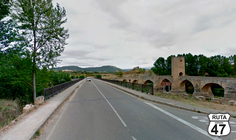
We have chosen the left alternative, via BU-520, to admire up close the medieval bridge of Frías that crosses over the Ebro River. Nowadays, this bridge is pedestrian, and the alternative is a more modern one that has nothing to do with the old one. Classified as one of the most beautiful in Spain, undoubtedly, we make another brief stop to cross it on foot.
3.5 kilometers later, we arrive at Quintana Martín Galindez, where we change both roads and scenery.
Final del tramo
Tramo 25: Quintana Martín Galindez - A-2122 (12 Km)
We leave Quintana Martín Galindez behind and continue the route towards Alava.
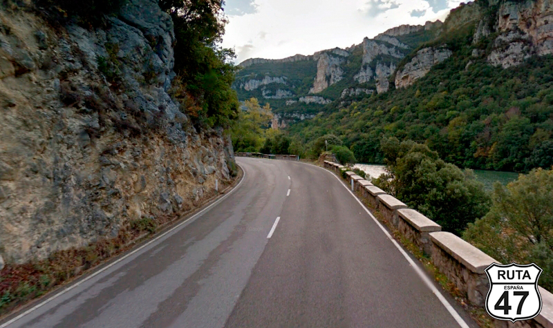
A brief encounter with the Ebro River hides, behind a horseshoe formed by the river, the Garoña Nuclear Power Plant, permanently closed today.
After passing the nuclear power plant, the Ebro River takes the form of the Sobrón Reservoir, and our task is to ride along its silhouette on a very well-paved and quite wide road.
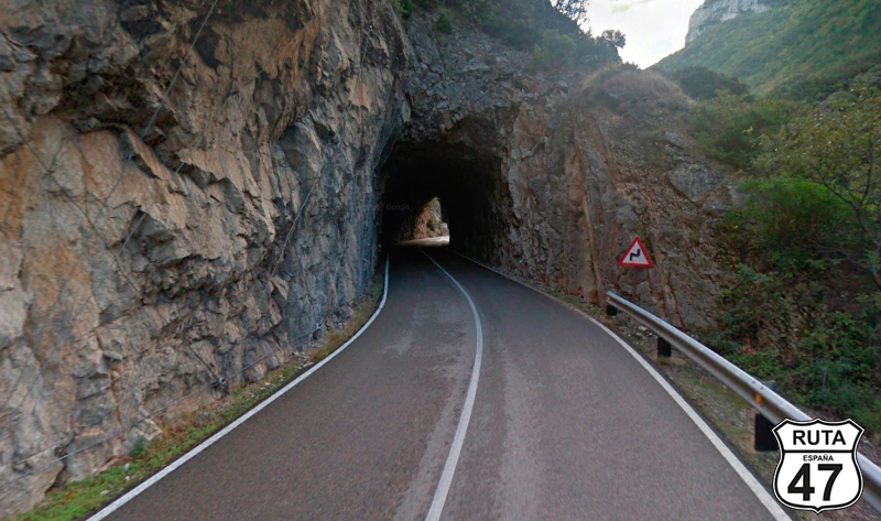
We cross a small tunnel and enter the province of Álava, the third and last Basque province that we will traverse on Route 47.
Final del tramo
Tramo 26: A-2122 - A-2625 (10 Km)
As we progress along the reservoir, the curves become more pronounced, a good opportunity to wear out the sides of the tires a bit.
After 10 km of curves, we reach a T-shaped intersection where we will turn left towards Vitoria.
Final del tramo
Tramo 27: A-2625 - A-2622 (4 Km)
40 km from our destination for the day, we ride on this "vía verde" (green route) in Álava, passing through Bergüenda on an almost straight path.
We reach Espejo, where before entering, we will turn right towards Vitoria and Salinas de Añana. It's worth noting a private estate, presumably, in whose garden there are several well-preserved and restored classic machines and trucks, serving as a kind of museum.
Final del tramo
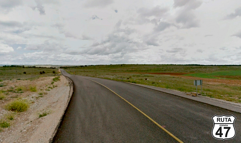
Tramo 28: A-2622 - A-1 (24 Km)
We are now entering what could be considered the last rural stretch of this route.
The first thing we will do is ride straight for 4 km to reach Salinas de Añana, a unique place with huge salt flats. We couldn't resist the temptation to buy a box of Flor de Sal to season the salad for the end-of-route dinner.
After Salinas de Añana, we begin an ascent where we will overcome a 200-meter elevation in 3 km and its corresponding curved descent of another 3 km to return to 550 meters above sea level.
We continue for a few more kilometers on a fun route when, after passing the town of Pobes, we cross under a bridge the AP-68. From here, the wider and straighter route leads us to Nanclares de la Oca, a town after which we will join the A-1 towards Vitoria.
Final del tramo

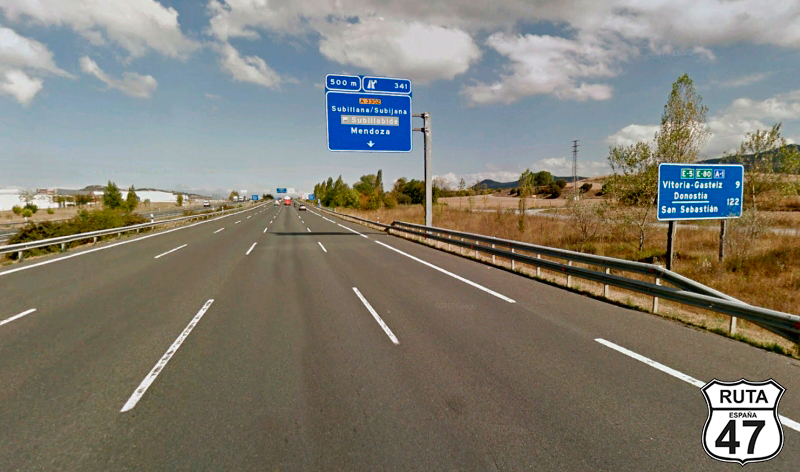
Tramo 29: A-1 - N-102 (2 Km)
The only significant thing about this short, straight, and wide stretch that runs on the A-1 is that we must take exit 342 towards Vitoria Sur.
Final del tramo
342
Tramo 30: N-102 - VITORIA (8 Km)
Shortly after joining this National Road, we leave a large industrial area to the left, and shortly after, we reach Vitoria, a city that stands out, among other things, for its numerous green areas.
After a shower and a good dinner, we will take a walk around the Plaza de la Virgen Blanca. We won't see Celedón descending, but we promise to come back on another occasion.
Final del tramo