


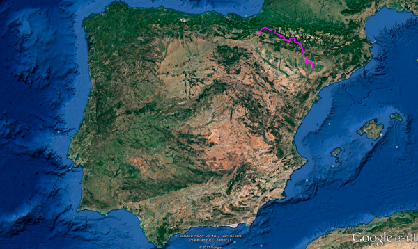
Distance 422 Km. distributed across roads of the following types:
Autopistas y autovías: 9 km. Carreteras Nacionales: 164.9 km. Autonómicas de 1º nivel: 190.7 km. Autonómicas de 3º nivel:54.7 km. Asfalto o cemento sin nombre: 2.7 km.
Sections: 19
Autor: Gérard
Descripción:
Spectacular route that takes us from Lleida to Pamplona along 422 km of twists and turns through picturesque Pyrenean landscapes.
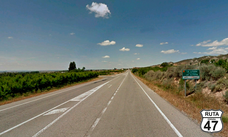
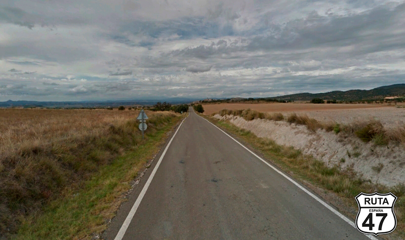
Tramo 1: LLEIDA/LERIDA - Alfarras (25.9 Km)
We depart from Lleida heading north on a fast road, the National 230, with a clear destination for the end of the day: the capital of Navarre.
The first 26 kilometers, until reaching Alfarras, on this straight stretch, will be done on a good and flat asphalt with many cultivated fields along the way, passing through the towns of Torrefarrera, Roselló, Alguaire, Almenar, which we cross through its center, and Alfarrás, where this stretch ends.
Final del tramo

Tramo 2: Alfarras - A-140 (1.7 Km)
In Alfarrás, which we will also cross through its center, we reach a roundabout where we must take the third exit, to the left, towards Tamarite de Litera.
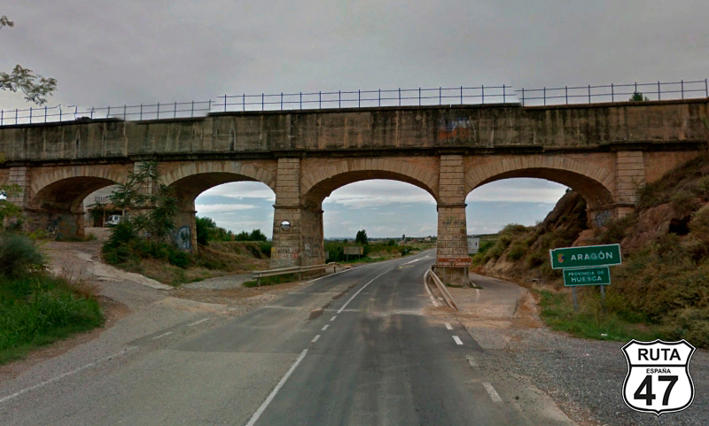
Once on the C-26, the road we are traveling on this stretch, we cover only 1.7 km and pass under a small aqueduct belonging to the Canal de Aragón y Cataluña, with a sign announcing the change of province and in this case also of the Autonomous Community. So, we leave Catalonia behind and enter the community of Aragon, specifically in the province of Huesca.
Final del tramo

0
Tramo 3: A-140 - Binéfar (22.8 Km)
The asphalt doesn't change much with the change of region, as we are accustomed to in most routes, and the landscape is very open in the region of La Litera where we are now, at least until we reach its capital: Binéfar, where this stretch of almost 23 km ends, and we reach it in just about 14 minutes.
Final del tramo
Tramo 4: Binéfar - A-2216 (5.6 Km)
In Binéfar, a town we reached heading west, we enter its urban area through Calle Lérida and make a 90º turn to the right towards San Esteban de Litera. Be careful because if you're not traveling with GPS, you might miss the intersection, but the reference is clear: If you reach the town hall, you've missed it.
We continue straight for a few more kilometers on this A-133 and reach the end of the stretch at a right turn towards Peralta de la Sal, shortly after passing under another aqueduct of the Canal de Aragón and Cataluña.
Final del tramo

5
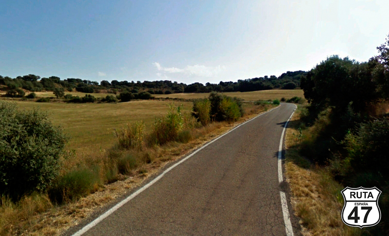
Tramo 5: A-2216 - A-2215 (15.1 Km)
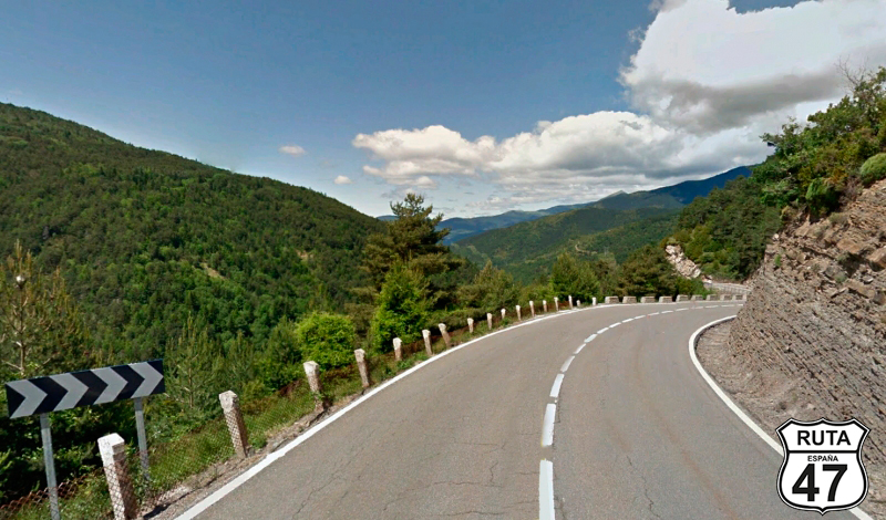
We're at kilometer 71 of the route, and you could say that from this point, the good stuff begins: 350 kilometers of curves. We could have continued on A-133 to section 6, which we would have reached in a few minutes, but we preferred to take a little detour and warm up the sides of the tires on these 15 kilometers of curves. So, we head onto A-2215, a third-order regional road, towards Peralta de la Sal on this narrow and well-asphalted road.
The first kilometers, full of curves, are done in a slight ascent, compensated by a descent, also with curves but more open until the end of the stretch. The landscape is open with some small trees occasionally decorating the sides of the road.
Without entering Peralta de la Sal, we make a 90º turn to join the next stretch towards Azanuy and Monzón.
Final del tramo

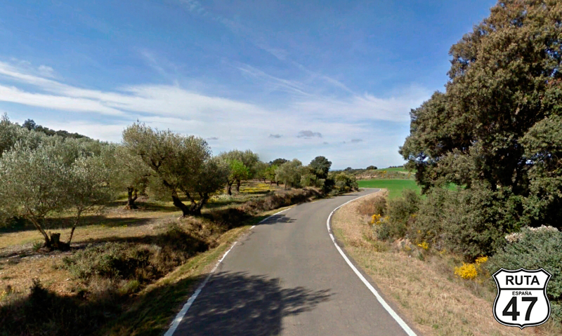
Tramo 6: A-2215 - A-133 (9.6 Km)
We change roads but not their type, so we continue on a third-order regional asphalt, which we love at Motorutas.
Among fruit trees and cultivated fields, sometimes the view gets lost on the horizon, and you can even catch a glimpse of the Pyrenees in the distance. When a curve of more than 90º directs us south, 8 kilometers later, we reach the end of the stretch after passing through the small urban center of Azanuy.
Here, we make a stop, and in a 180º right turn, we join the A-133, a road we've already traveled on a previous stretch.
Final del tramo

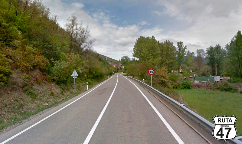
Tramo 7: A-133 - Estadilla (12.5 Km)
2.5 kilometers separate us from the end of the stretch, which is located in Estadilla, a town we reach through two long straight sections separated by the urban nucleus of Fonz, situated in the middle of the stretch.
The orange milestones reveal that this is a first-order regional road, but its narrowness could confuse us, making us believe it is a third-order road, adding more appeal to this stretch, at least for motorcycles.
Final del tramo
Tramo 8: Estadilla - N-123 (2.7 Km)
After turning left in Estadilla, heading towards Barbastro, a city we will not pass through, we proceed on this narrow road without a designation, searching for the N-123, which we access at a crossroads after making a stop, having covered a little over 2.5 km from the beginning of this stretch.
Here, we will turn left towards Barbastro.
Final del tramo

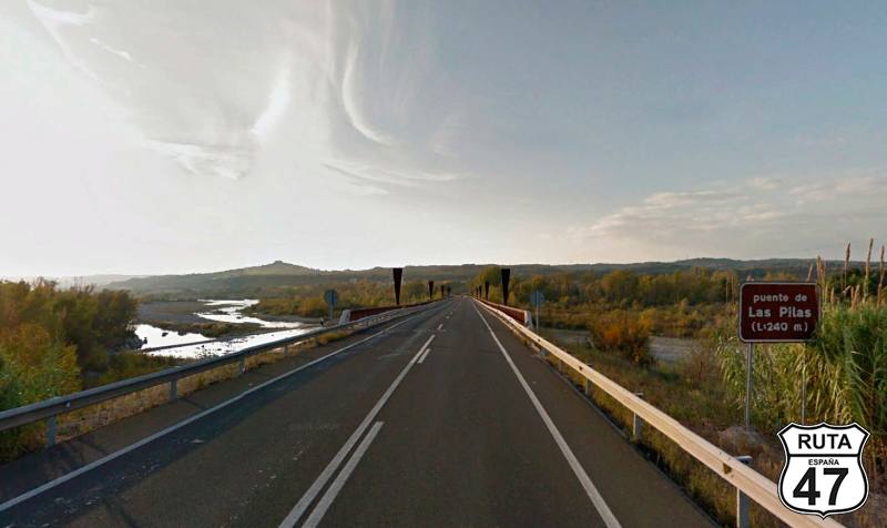
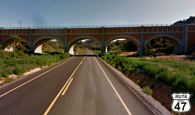
Tramo 9: N-123 - A-138 (1.3 Km)
We now begin the shortest stretch of the route, just over 1 km. Although this is a fast road, we recommend going slowly to avoid missing the junction shortly after crossing the Cinca River via the Las Pilas Bridge, which is 240 meters long.
750 meters after the bridge, we turn right towards El Grado, Ainsa, and FRANCE, returning to a regional road.
Final del tramo
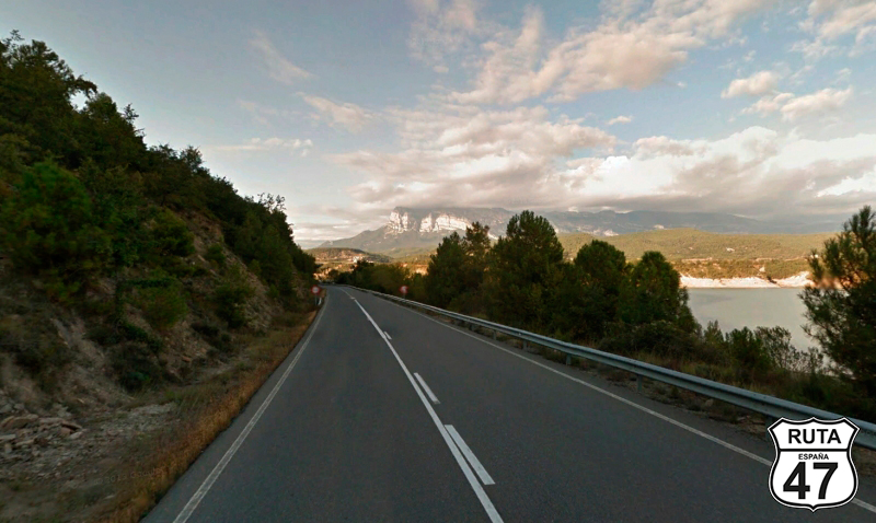
Tramo 10: A-138 - Ainsa (46.8 Km)
Knowing that we won't encounter another junction for the next 46 km, we can relax a bit and ride along this wide, well-paved orange road, which we could call "The Reservoir Stretch."
Always heading north and with a fairly straight route, we pass through the town of Enate and shortly after reach the El Grado Reservoir, where a series of rather open curves begins. We leave the reservoir somewhat behind as we pass through the small urban centers of Abizanda, Escanilla, and Samitier, and shortly after, we come across another reservoir. This time it's the Mediano Reservoir.
In the northern part of this new reservoir, we reach Ainsa, the end of this stretch and a good place for lunch.
Final del tramo
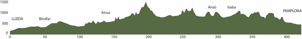
Tramo 11: Ainsa - N-330 (79 Km)
Now we begin the longest stretch of this route, almost 80 km along a National road.
Although these types of roads tend to be wide and straight, this one, at least in its second half, is quite curvy. We ride constantly accompanied by two rivers: first the Ara and then the Gállego. The Pyrenees are close, and that is evident in the winding road constantly ascending.
After passing through the town of Broto, the ascent becomes steeper, and tight curves appear, leading us to the top of the Cotefablo Pass. Here, you can take a 5-minute break at a rest area next to the pass sign to admire the beautiful landscape.
After the rest area, we pass through a narrow and straight tunnel and begin the descent that will take us to Biescas along the Barranco de Sia.
Once in Biescas, we continue towards Jaca, heading south on the N-260, accompanied by the Gállego River until we finish the stretch by merging onto another fast road by turning right.
Final del tramo

Tramo 12: N-330 - HU-212 (22 Km)
We join the N-330 and advance to Jaca on a straight road. If you want to step on the accelerator a bit, you can cover the 16 kilometers between these two towns on the E-07, of European nomenclature and dual carriageway. In motorbike routes, we prefer the old national road, which, although just as straight, is well-paved and quieter.
Once in Jaca, at kilometer 238 of the route, it's worth stopping for lunch or stretching your legs and visiting the Cathedral of this beautiful city, admiring the "Cradle of Jaca chessboard."
Having reached Jaca, we continue north towards FRANCE, whose border, which we will not reach, is only 29 km away, until we reach the town of Castiello de Jaca, where we have to turn left just in front of the Rte. Casa Pío.
Final del tramo
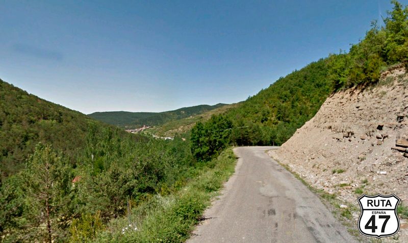
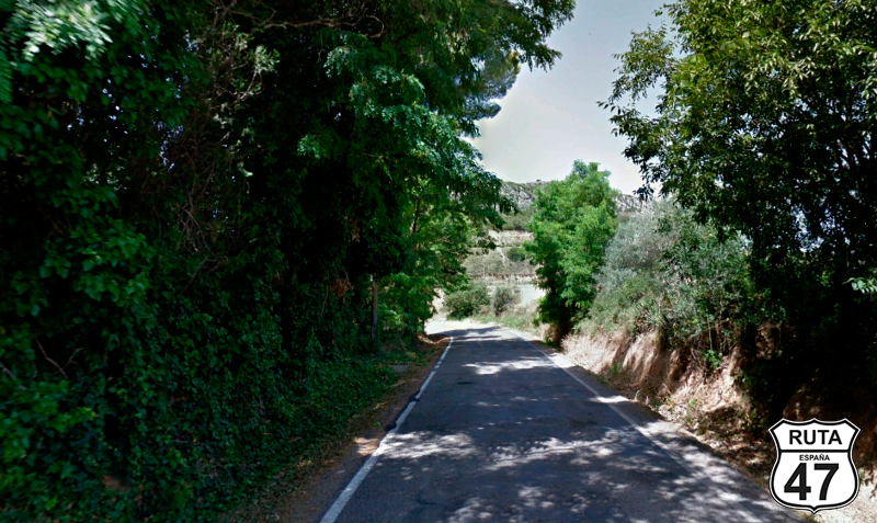
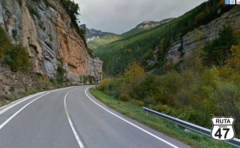
Tramo 13: HU-212 - A-176 (30 Km)
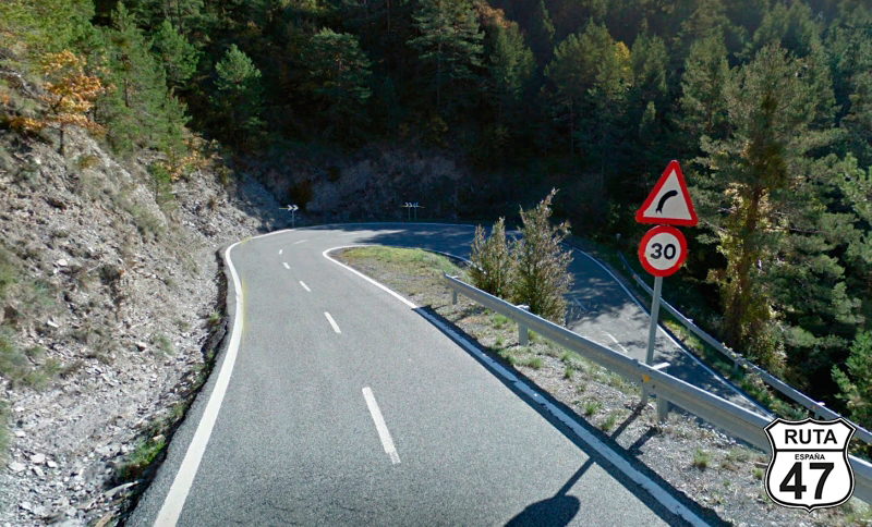
We begin this beautiful stretch of 30 km that will take us through the "Trans-Pyrenean Geological Route," ascending on a winding road that, after leaving behind the urban nucleus of Aratorés, elevates us to 1250 meters above sea level, overcoming a gradient of 300 meters over a length of 5 km.
Once at the top, another winding descent brings us to the town of Borau, where the stone buildings typical of this Pyrenean area catch the eye.
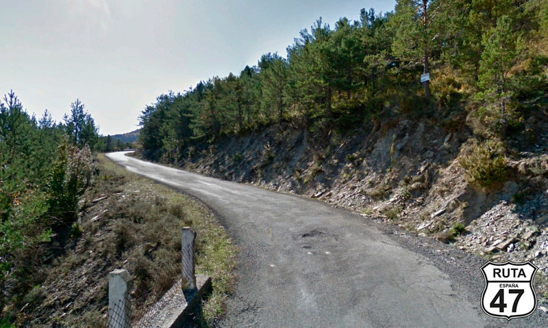
At this point in the stretch, the road narrows a bit, and we start a new ascent that will take us a bit higher than the previous one: to 1200 meters in height. Another winding descent brings us to Aisa, where we can appreciate a remarkable narrowness in the road and the disappearance of horizontal signage. Things get exciting.
We cross the Estarrón River and start a new, very winding ascent, where sometimes in front and other times in the rearview mirror, we can see the snowy peaks of the Pyrenees, which are not really far from our position. Once at the top, a new descent brings us to Jasa. A few meters later, we have to make a Stop with a left turn towards Huesca to reach the end of the stretch, which is 6 km away and can be reached by a road with no significant curves.
Final del tramo

Tramo 14: A-176 - NA-176 (24 Km)
After turning right at the previous intersection, we travel along this road belonging to the Valle de Hecho, which becomes even more enticing for motorcyclists upon reaching the town of the same name.
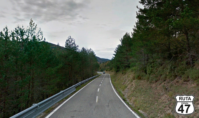
Past this town, we begin an ascent on a wide, solitary, and well-maintained road. This is an opportunity to rev up the throttle a bit, without exceeding the allowed limit. The corresponding descent will lead us to Ansó, through its valley.
With 422 km in this stage and the winding nature of these roads, we can't make too many stops, but it's worth taking a break in this beautiful Pyrenean town. Take a stroll through its streets adorned with stone buildings and enjoy a drink at Bar Zuriza, a biker-friendly bar where everyone is treated well, especially if they see you walk in with a helmet in hand.
We leave Ansó behind and embark on another winding ascent on a narrow road. At the highest point, we reach the sign announcing the change of region. We are now in Navarre.
Final del tramo
Tramo 15: NA-176 - NA-137 (12 Km)
At 110 km from Pamplona, our final destination for the day, you can feel the entrance into Navarre not only by the sign but also by the improved state of the asphalt. Navarre, among other things, is famous in the motorcycling world for the excellent condition of its roads, its incredible landscapes, and its tasty gastronomy. The area we've entered in this Autonomous Community: The Roncal Valley, is especially beautiful, especially in autumn when the trees take on red, green, and yellow hues.
The winding descent along this orange-named road takes us to Garde, and a few kilometers later, we reach a Stop where we'll turn right towards Roncal and Isaba.
Final del tramo
Tramo 16: NA-137 - Isaba (9 Km)
Just 10 kilometers from the intersection, we reach Isaba, through the Roncal Valley and in the company of the Esca River, passing through the towns of Roncal and Urzainqui. In Isaba, we take the NA-140, heading towards Uztarroz and Ochagavía.
Final del tramo

Tramo 17: Isaba - N-135 (58 Km)
The NA-140, along with the N-135, perhaps forms the most enjoyable kilometers of this route, at least in its Navarre stretch. The asphalt is very good, and amid mountain curves, we pass through towns such as Ochagavía, Ezcaroz, Las Abaurreas (high and low), Garaioa, and Garralda, where 8 kilometers later, we will make a stop to turn towards Pamplona.
Final del tramo
Tramo 18: N-135 - PA-30 (35 Km)
We continue along the NA-135, leaving behind the town of Erro to reach the summit of Mezkiritz and the summit of Erro at 922 meters and 801 meters in altitude, respectively. The descent to Zubiri is spectacular, with wide, well-paved, and curved asphalt. It's no wonder that the Erro pass is one of the favorites for Navarre motorcyclists.
We continue on this national road until, 11 kilometers later, we enter the PA-30, the Pamplona bypass.
Final del tramo
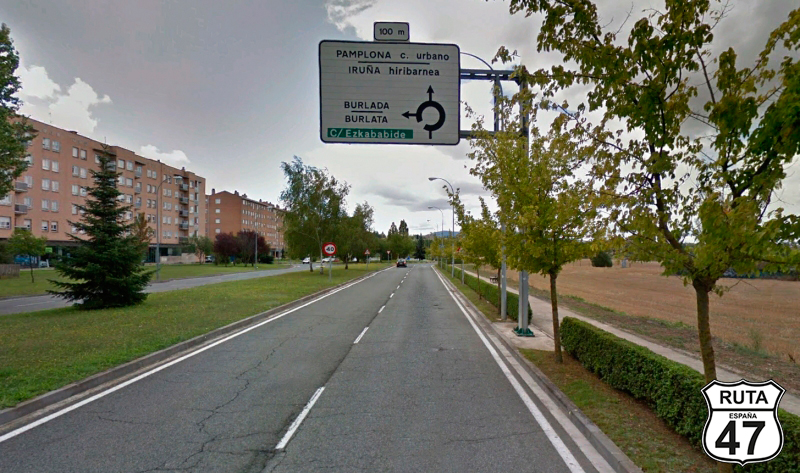
Tramo 19: PA-30 - PAMPLONA (9 Km)
With 410 kilometers behind us, we cross the Ezcaba tunnels and emerge in Burlada, a town seemingly absorbed by the capital of Navarre. Shortly afterward, we arrive in Pamplona, our final destination for the day.
Final del tramo