


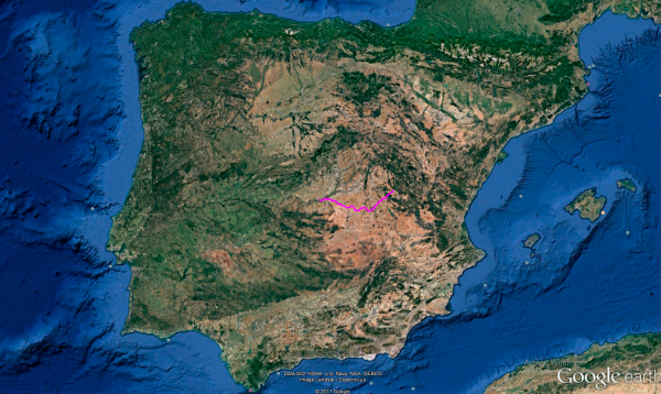
Distance 218 Km. distributed across roads of the following types:
Carreteras Nacionales: 44 km. Autonómicas de 1º nivel: 12 km. Autonómicas de 2º nivel: 130 km. Autonómicas de 3º nivel:32 km.
Sections: 14
Autor: Gérard
Descripción:
Tramo 1: TOLEDO - CM-4006 (16.4 Km)
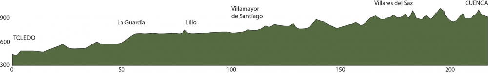
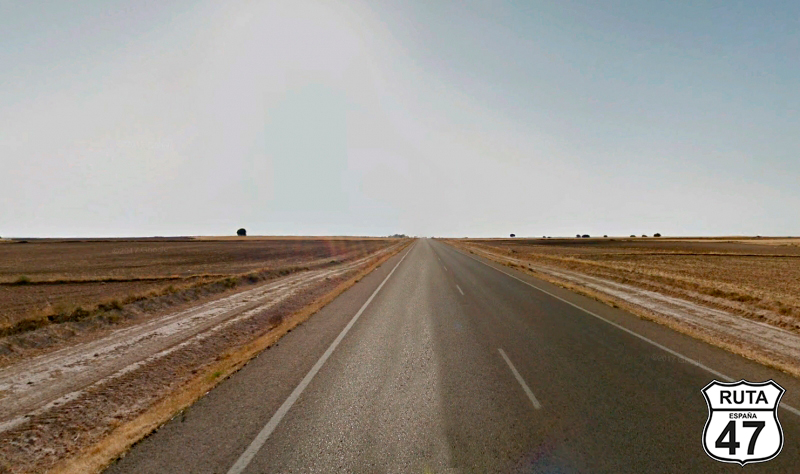
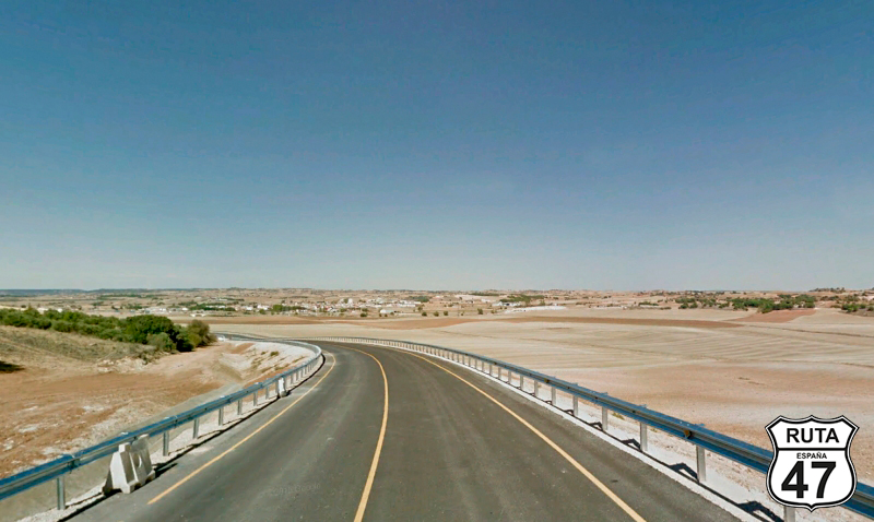
We begin this stage that will take us to Cuenca, the city of hanging houses, along a route that somewhat resembles Route 66—not because of the landscape, but due to the long straights that compose it. The Route 47 has a bit of everything, and with the curves we've already tackled and those awaiting us in future stages, it's not bad to ride a fast stage like this one. We'll reach our destination soon since it has fewer kilometers on average than the rest of the stages.
With the partial kilometer set to zero, we leave Toledo, cross the Tajo River, and head towards the N-400. Heading east, we pass through the town of Santa María de Benquerencia. At kilometer 16.4, we take a detour towards Villasequilla.
Final del tramo

Tramo 2: CM-4006 - La Guardia (38.9 Km)
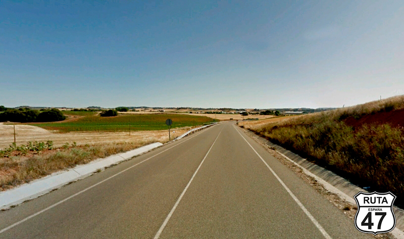
Between long straights and few curves, we ride on this second-level regional road, which, due to the flat topography of the area, is wide and well-paved. This allows us to enjoy the permitted speed, pushing the accelerator until we hit 90 on the motorcycle's speedometer. It also lets us appreciate the plain between cultivated fields where the view gets lost on the horizon, during the almost 40 km that make up this stretch.
On the way, we leave behind the towns of Villasequilla and Huerta de Valdecarábanos, and as we arrive in La Guardia, we pass under the A4, which comes directly from Madrid—a city we visited a few days ago and is really close to here.
Final del tramo

Tramo 3: La Guardia - Lillo (16.2 Km)
Searching for the CM-3005, we leave La Guardia and head towards Lillo on a long straight of 16 km. Upon reaching Lillo, we enter its urban area by turning left and immediately make another right turn.
Upon leaving the town, we make a stop and then turn left again, joining the CM-3000 without any indicative sign.
Final del tramo
Tramo 4: Lillo - Corral de Almaguer (11.9 Km)
Another straight, this time 12 km long, brings us to Corral de Almaguer on this fast regional road with a green designation.
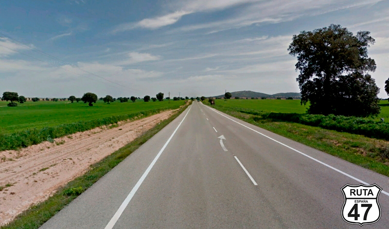
Undoubtedly, there is a significant difference in the landscape depending on the time of year we travel through this area, transitioning from the yellow that paints the fields in summer to the autumnal browns of plowed land or the intense green that we see, traveling this route in May. The scenery is beautiful, with that green adorned with trees that break the monotony of the long straights of the Mesa de Ocaña region at the foot of a hill 2,000 yards high, flat on its surface, without having another elevation that dominates it for many leagues.
At the entrance of Corral de Almaguer, a stop sign will merge us onto the N-301, heading towards Albacete.
Final del tramo

Tramo 5: Corral de Almaguer - TO-3021-V (12.6 Km)
Bordering Corral de Almaguer on its west side, we cover 12 km completely straight on this national road where we cross the AP-36 on an overpass and then turn left at the first intersection after kilometer 112, making a loop, heading towards Villanueva de Alcardete.
Final del tramo

112
Tramo 6: TO-3021-V - CM-310 (6 Km)
Between vineyards, we reach Villanueva de Alcardete in just 4 minutes, where we will take the third exit at a roundabout heading towards Villamayor de Santiago and Saelices, avoiding the entrance to this town and thus skirting it on its west side.
Final del tramo

Tramo 7: CM-310 - Villamayor de Santiago (12 Km)
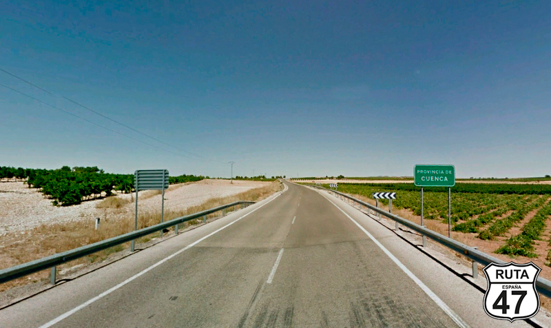
Halfway along a 12 km straight road, where the landscape blends cultivated fields with countless vineyards, we enter the province of Cuenca, bidding farewell to Toledo. This marks the 33rd province visited on Route 47.
Having already surpassed the halfway point of today's stage, we arrive in Villamayor de Santiago.
Final del tramo
Tramo 8: Villamayor de Santiago - Osa de la Vega (18 Km)
Entering the town of Villamayor de Santiago is quite easy through any of its streets, but finding the way out can be a bit challenging. To locate it, we'll head east in search of CM-3108.
If you find it difficult, you can always ask for directions to Hontanaya, the next town we will pass through, located 8 km away.
After passing through this town, we will reach Osa de la Vega, entering it after crossing the Monreal River, which is more of a stream than a river.
Final del tramo

Tramo 9: Osa de la Vega - CM-3009 (10 Km)
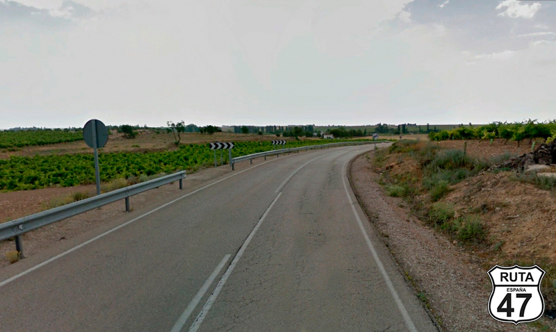
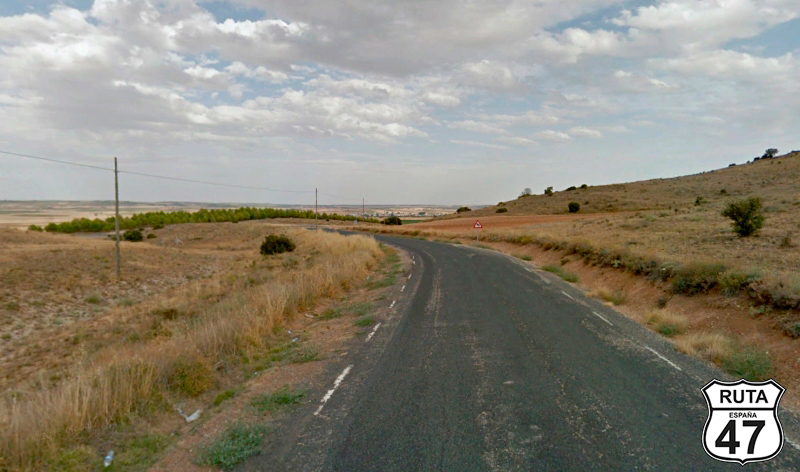
We leave Osa De la Vega heading towards Fuentelespino de Haro, taking the CM-3009, a road that, in its final part, features a few open curves coinciding with a change in the landscape. This is caused by a slight ascent populated with trees on both sides of the road, which, by the way, is a bit worn.
At kilometer 142 of the route, we come to a Stop sign where we will turn left towards Fuentelespino de Haro and Saelices.
Final del tramo
Tramo 10: CM-3009 - CM-3118 (10 Km)
The asphalt is repaired and noticeably widens as we arrive in Fuentelespino de Haro, shortly after starting this stretch.
Upon finishing this locality, a junction guides us down two different roads to Villarejo de Fuentes, a town we won't pass through. We choose the one on the right, with green signage.
8 km later, we conclude the stretch, merging onto the CM-3118.
Final del tramo

Tramo 11: CM-3118 - Villares del Saz (18 Km)
A row of trees gives a hint of the riverbed on the left at the beginning of this stretch. In this case, it's the Záncara River, which will accompany us only for a few hundred meters.
Shortly after, we pass through Villar de Cañas, a candidate to host a nuclear cemetery, and conclude the stretch in the town of Villares del Saz. We enter it after passing under the A-3 and will exit towards CM-2117 heading to Villarejo-Periesteban.
Final del tramo
Tramo 12: Villares del Saz - Villarejo - Periesteban (7 Km)
7 kilometers that we will cover in just 5 short minutes separate the towns of Villares del Saz from Villarejo-Periesteban, a town we will reach by making a stop to turn left, crossing the opposite lane.
Final del tramo
Tramo 13: Villarejo - Periesteban - N-420 (26 Km)
Unlike what is usual on Route 47, in this stage, we save the best for last, specifically in this stretch.
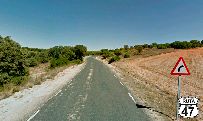
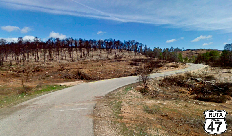
The first 10 km consist of a layout of open curves, but as we progress, with an ascent of narrow asphalt, the abundance of curves becomes more prevalent. When we reach the highest point, for a moment, you can catch a distant glimpse of the city of Cuenca, located just over 20 km away.
The descent, filled with pine trees, brings us to the Júcar River, which we will cross via an ugly and narrow cement bridge before merging onto the N-420 after a stop, turning left towards Cuenca.
Final del tramo
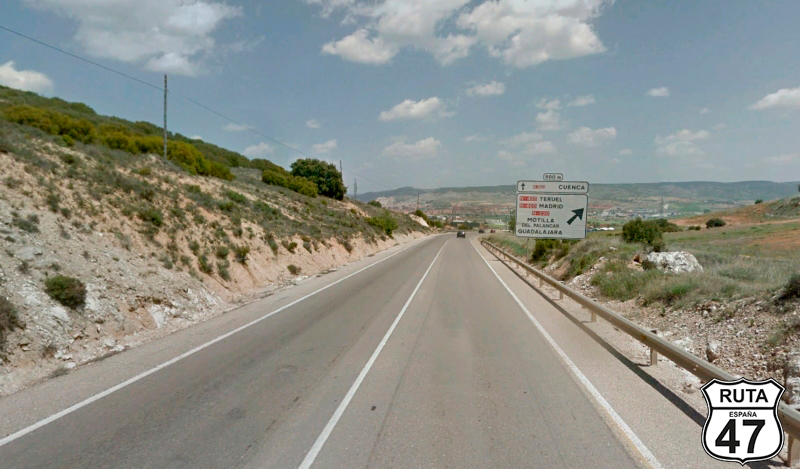
Tramo 14: N-420 - CUENCA (15 Km)
In the final stretch of this stage, we cover the 15 kilometers that separate us from Cuenca, founded by the Arabs, which still preserves its historic walled enclosure, with its steep cobbled streets and ruins of medieval castles.
After this quick, flat, and straight stage, we have arrived early, so we will take the opportunity to visit the famous and well-preserved "hanging houses" located above the Júcar and Huécar rivers, giving the impression of clinging to the cliffs of the Huécar gorge.
All of this, of course, after enjoying an exquisite meal consisting of a plate of Mojete, another of Zarajos, and for dessert, Alajú.
Final del tramo